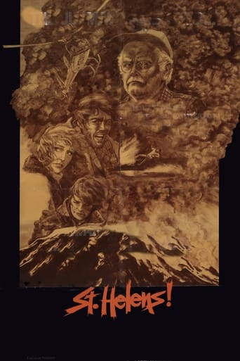
排山倒海 (1982)
St. Helens
圣海伦斯山是一座死火山,但突然之间周围出现了异常,池塘里的鱼不断跃出水面,动物惊恐不安,小地震不断发生。地质学家杰告诫大家火山即将爆发,迅速撤离小镇,遗憾的是并未引起人们的注意。火山终于爆发,狂风大作,山崩地裂。人们狂奔乱叫,森林成了一片火海,小镇也被岩浆淹没...... 【上海译制】配音演员:赵屹鸥、沈晓谦、曹毅、白涛、张欣、王建新、程玉珠、野芒、姜玉玲、范蕾颖
- 上映日期
- 1982-01-01
- TMDB
- 6.0 / 10 (12)
- 片长(分钟)
- 1小时32分钟
- 类型
- 动作, 惊悚, 电视电影
- 导演
- Ernest Pintoff
演员阵容
- 阿特·卡尼 — Harry Truman
- David Huffman — David Jackson
- Cassie Yates — Linda Steele
- 阿尔伯特·萨尔米 — Clyde Whittaker
- 罗恩·奥尼尔 — Otis Kaylor
- Tim Thomerson — Sheriff Wayne Temple
- 比尔·麦金尼 — Kilpatrick
- Redmond Gleeson — Hendricks
- Nehemiah Persoff — Mr. Ellison
- Brendan Burns — David Crockett
- Henry Darrow — Lloyd Wagner
- Danny Chambers — Col. Arnholt
趣闻
St. Helens is a 1981 made-for-cable HBO television film directed by Ernest Pintoff, and starring David Huffman, Art Carney, Cassie Yates, and Albert Salmi. The film centers on the events leading up to the cataclysmic 1980 eruption of Mount St. Helens in Washington, with the story beginning on the day volcanic activity started on March 20, 1980, and ending on the day of the eruption, May 18, 1980. The film premiered on May 18, 1981, on the first anniversary of the eruption.
Production
The entire movie was shot on location in Bend, Oregon, and at Mount Bachelor in Central Oregon's Cascade Range. In the film, both Mount Bachelor and the South Sister (of the Three Sisters volcanic chain) served as the pre-eruption Mount St. Helens, and the film opens with a picture of Mount Bachelor and the Central Oregon Cascades.
The setting for the pre-eruption Spirit Lake was actually Sparks Lake, located west of Mount Bachelor.
The setting for the Mount St. Helens Lodge was Elk Lake Lodge, located about 30 miles (48 km) from Bend along Cascade Lakes Scenic Byway.
The film used Cascade Lakes Scenic Byway (Cascade Lakes Highway) to depict Washington State Route 504 (known now as the Spirit Lake Memorial Highway).
The photos during the depiction of the May 18, 1980, eruption showing the north face of Mount St. Helens collapsing and exploding were taken by an amateur photographer at the Bear Meadow campsite 11 miles (18 km) northeast of the peak. The photographer, Gary Rosenquist, became a household name shortly after the eruption, and his photo sequence was widely used by the scientific community to reconstruct the events that led to the eruption.
在维基百科阅读更多 · 文本来自维基百科,CC BY-SA 4.0。数据来自 Wikidata。